Free map quiz
Learn the provinces of the Philippines on a map
Practice finding the 118 provinces of the Philippines on an interactive map. Each prompt names a place; tap it on the map and see the answer before the next one.
Start the quizFree to start as a guest. No account needed.
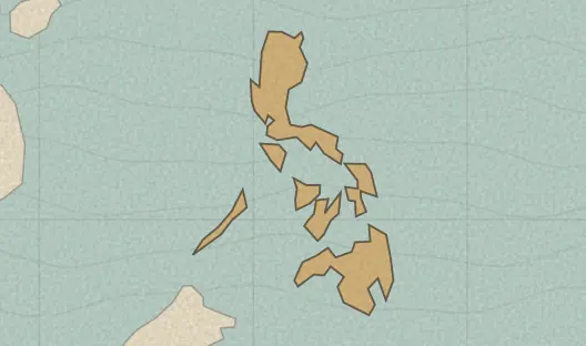
The 118 provinces in this quiz
- Abra
- Agusan del Norte
- Agusan del Sur
- Aklan
- Albay
- Angeles
- Antique
- Apayao
- Aurora
- Bacolod
- Baguio
- Basilan
- Bataan
- Batanes
- Batangas
- Benguet
- Biliran
- Bohol
- Bukidnon
- Bulacan
- Butuan
- Cagayan
- Cagayan de Oro
- Caloocan
- Camarines Norte
- Camarines Sur
- Camiguin
- Capiz
- Catanduanes
- Cavite
- Cebu
- Cebu
- Compostela Valley
- Cotabato
- Cotabato
- Dagupan
- Davao
- Davao del Norte
- Davao del Sur
- Davao Oriental
- Eastern Samar
- General Santos
- Guimaras
- Ifugao
- Iligan
- Ilocos Norte
- Ilocos Sur
- Iloilo
- Iloilo
- Isabela
- Kalinga
- La Union
- Laguna
- Lanao del Norte
- Lanao del Sur
- Lapu-Lapu
- Las Pinas
- Leyte
- Lucena
- Maguindanao
- Makati
- Malabon
- Mandaluyong City
- Mandaue
- Manila
- Marikina
- Marinduque
- Masbate
- Mindoro Occidental
- Mindoro Oriental
- Misamis Occidental
- Misamis Oriental
- Mountain Province
- Muntinlupa
- Naga
- Navotas
- Negros Occidental
- Negros Oriental
- Northern Samar
- Nueva Ecija
- Nueva Vizcaya
- Olongapo
- Ormoc
- Palawan
- Pampanga
- Pangasinan
- Paranaque
- Pasay
- Pasig
- Pateros
- Puerto Princesa
- Quezon
- Quezon City
- Quirino
- Rizal
- Romblon
- Samar
- San Juan
- Santiago
- Sarangani
- Siquijor
- Sorsogon
- South Cotabato
- Southern Leyte
- Sultan Kudarat
- Sulu
- Surigao del Norte
- Surigao del Sur
- Tacloban
- Taguig
- Tarlac
- Tawi-Tawi
- Valenzuela
- Zambales
- Zamboanga
- Zamboanga del Norte
- Zamboanga del Sur
- Zamboanga Sibugay
A useful way to practice
Start with the places on the coast or the border, then fill in the interior. A first full run shows which neighbors you mix up; a later unaided run is the one that moves your review progress.
Boundaries and names come from Natural Earth, a public-domain map dataset, so some names use local spellings and recent boundary changes may not appear yet.
Put the map to work in history
Once a place feels familiar, use it in a Terra Tempus history round: read a clue about a real, sourced event, place it on the map, then set it in time.
Try today’s history challenge →